
Collections
Maps
View our collection of historical maps of the area.
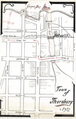
Thornbury circa 1912 as remembered by H. Elmer Cook
A hand drawn map of Thornbury, its businesses and residences, in around 1912. H. Elmer Cook, of Meaford, Ontario.
VIEW FULL RECORD
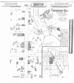
Thornbury Ontario October 1890
Map of Thornbury on October 1890. Population 1200, Water supply: Beaver River.
Scale: 50 feet = 1 inch
Source: Library and Archives Canada
VIEW FULL RECORD
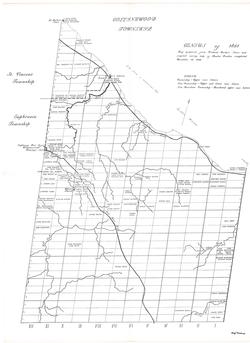
Map - Collingwood Township Census of 1851
Map prepared from Richard Rorke's notes and Charles Rankin's original survey map. It was completed December 18, 1838.
VIEW FULL RECORD
![Topographical Map of the Township of Collingwood [1872]](/public_docs/archival_items/th_2015-014w-CwoodTwpCensus1872.jpg)
Topographical Map of the Township of Collingwood [1872]
From original and other surveys by J. Fleming, 1872.
"The Mountain and other topography is as accurate as can be determined from surveys up to the present time. The names on the lots are from the Revised Assessment Rolls of the Municipality.'
"Occupants of lots are mostly owners, but some are tenants."
"Scale: 40 chains to an inch."
VIEW FULL RECORD
Home | About Us | Research Links | Contact Us | Browse | Collections | Subjects | Search | Communities |
©2024 All Rights Reserved. Then & Now - History of the Town of the Blue Mountains
We gratefully acknowledge the support of the New Horizon's Seniors Grant.
All data is subject to errors, omissions or revisions & is not warranted. Website developed & hosted by Running Tide Inc.